January 11 – March 18, 2007
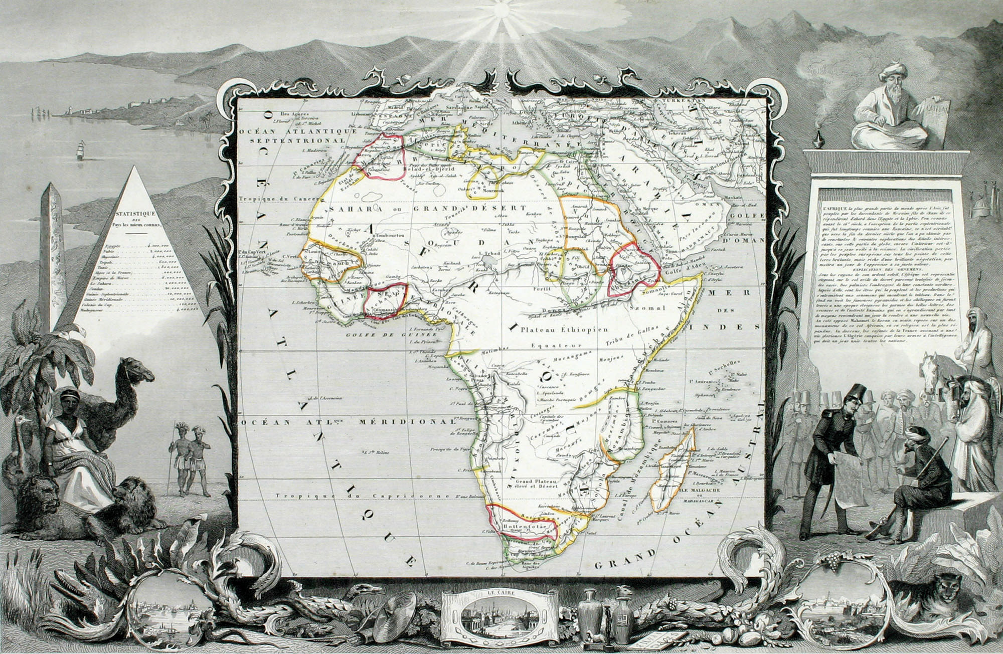
Victor Levasseur, Afrique, ca. 1845. Courtesy of DePaul University Special Collections, Richard Houk Cartographic Collection.
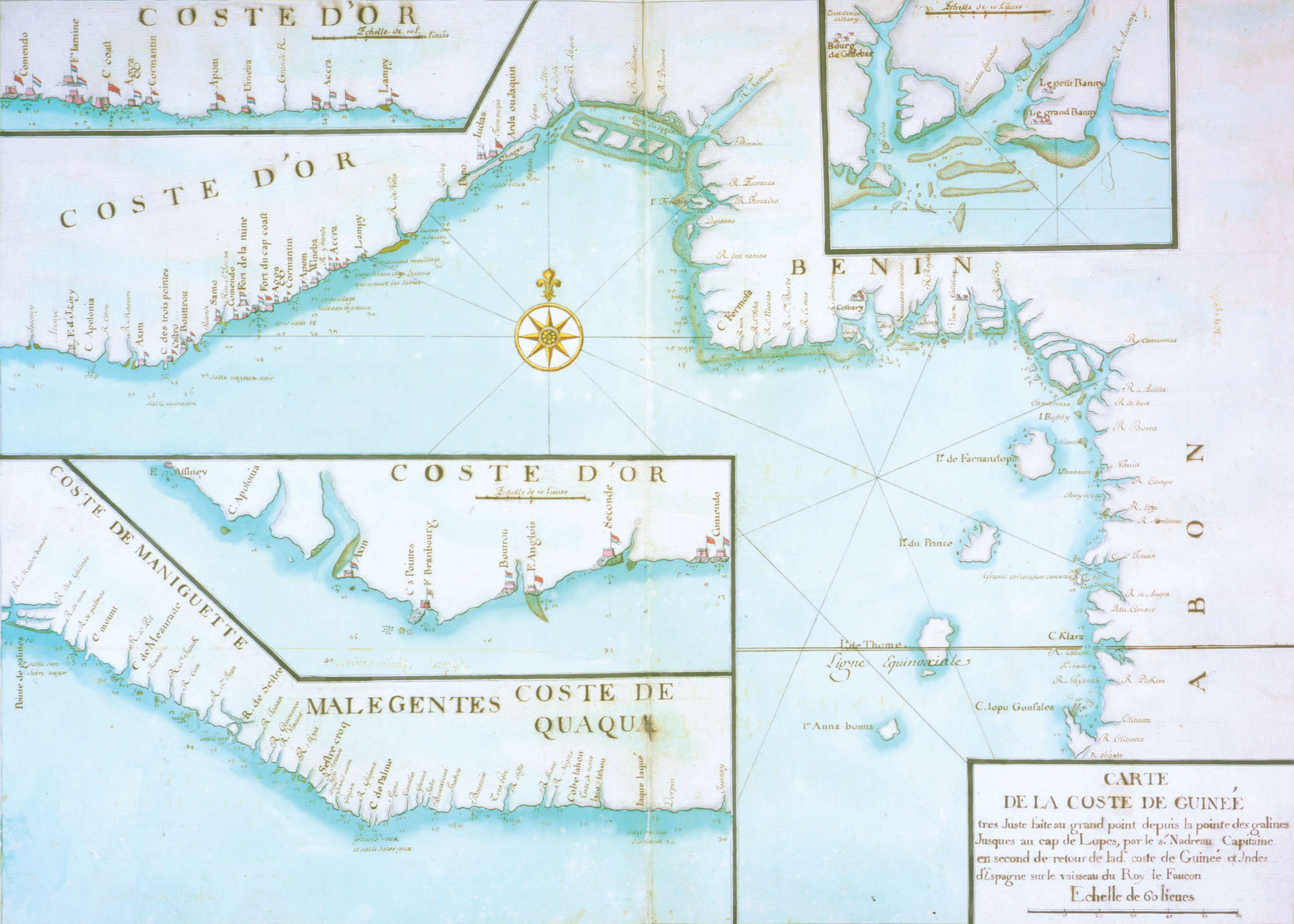
Nadreau, Le flambeau de la navigation, 1715. Courtesy of the Newberry Library, Chicago.
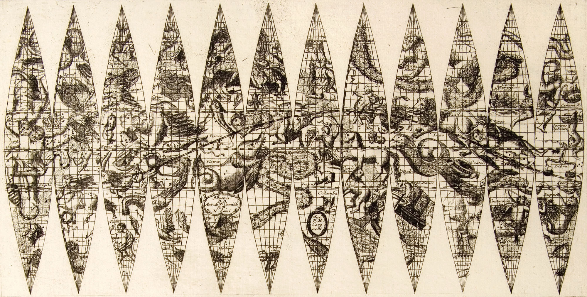
Vencenzo Coronelli, Celestial and Terrestial (detail), 1697. Courtesy of Adler Planetarium and Astronomy Museum, Chicago.
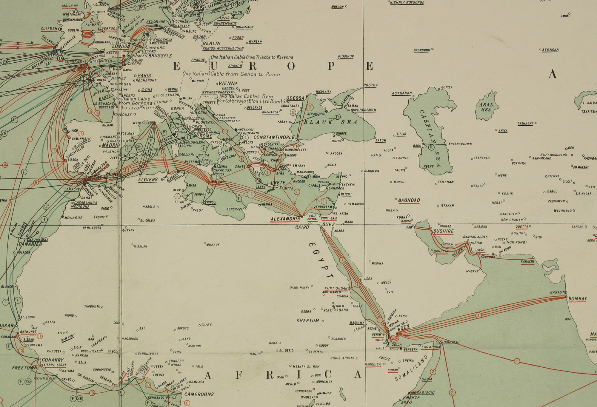
Radio and Cable Map of the World (detail), Geographical Section General Staff, United Kingdom, 1927. Courtesy of the American Geographical Society Library, University of Wisconsin Milwaukee Libraries.
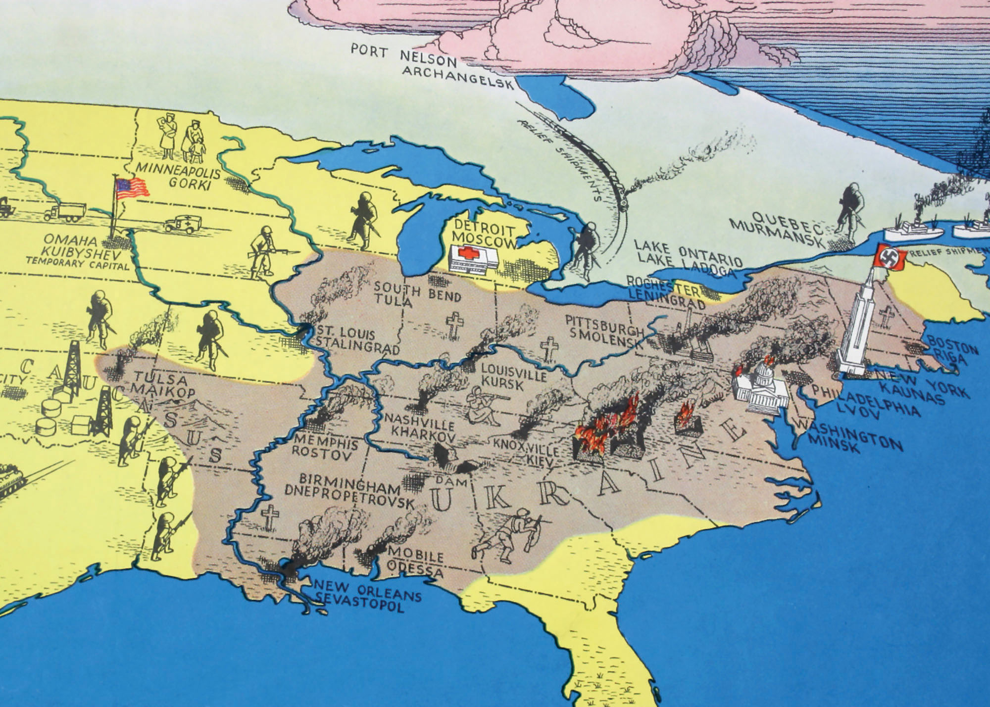
38,000,000 Escaped, 10,000,000 Died (detail), 1943. Courtesy of the American Geographical Society Library, University of Wisconsin Milwaukee Libraries.
This exhibition traces the ways cartography and other geospatial visualization and analytical technologies (such as Geographic Information Systems and satellite imagery) have shaped our perceptions of power and geopolitics, our planet, and each other. The tools of geography have supported imperial expansion, from early Dutch voyages of exploration through European colonization to the Cold War and beyond. Maps, globes, and remotely sensed imagery from the Newberry Library, the Adler Planetarium, and other collections illuminate the connection between knowledge and conquest. Cosponsored by the Department of Geography.